Buffelshoek Tented Camp Map & Directions
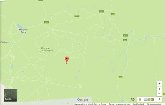
Address: Buffelshoek Camp Road, Manyeleti Game Reserve, Mpumalanga


Directions
BUFFELSHOEK CAMP DIRECTIONS The following options are available:- Self-drive to the camp (for directions please see below). Fly from Johannesburg, Durban or Cape Town to either Hoedspruit (Eastgate Airport) or Nelspruit (Kruger Mpumalanga International Airport) and then arrange a road transfer to the camp through our reservations office. Ashton Kruger Shuttle offers a daily shuttle service from Johannesburg/OR Tambo/Pretoria to Hoedspruit. Connecting transfers are then available to the camp. Both transfers can be booked through our reservations office. Buffelshoek GPS Coordinates: S 24°39.611' E 31°33.352' Directions from HOEDSPRUIT Drive south on the R40 for 24km, towards White River and turn left at the T-junction (S24°32.425' E31°01.915'). After 2km turn left on the R531 towards ORPEN Gate (S24°33.282' E31°02.306'). Drive for 35 km and then turn right just before the Kruger National Park boom gate (S24°32.528' E31°22.318'). From the turn-off the entrance to Manyeleti Game Reserve is 400m (S24°32.557' E31°22.447'). From here follow the MAIN CAMP signage. Turn right (S24°32.563'E31°22.538'). Turn left (S24°33.423'E31°23.403'). Keep right (S24°33.240'E31°23.599'). Turn right (S24°33.833'E31°26.925'). Keep left (S24°34.620' E31°27.034'). Pass the dam and keep right (S24°35.660' E31°28.448'). At the T-junction just past the Manyeleti Main Camp turn left (S24°36.412' E31°28.411'). Drive for 2 km and then turn right (S24°36.967' E31°29.408'). Drive another 10 km before turning right at the sign for Buffelshoek (S24°38.396'E31°33.360'). Drive for 600m and turn right (S24°38.613' E31°33.642'). Drive another 2.4 km and turn left (S24°39.546? E31°33.024'). Follow the track for 600m to the camp (S24°39.611' E31°33.352') Directions from NELSPRUIT Follow the R40 NORTH through Hazyview, Bushbuck Ridge and Acornhoek and continue in the Hoedspruit direction. 5km after the traffic light at Acornhoek (whilst travelling towards Hoedspruit) turn right on the R531 towards ORPEN Gate (S24°33.282' E31°02.306'). Drive for 35 km and then turn right just before the Kruger National Park boom gate (S24°32.528' E31°22.318'). From the turn-off the entrance to Manyeleti Game Reserve is 400m (S24°32.557' E31°22.447'). From here follow the MAIN CAMP signage. Turn right (S24°32.563' E31°22.538'). Turn left (S24°33.423' E31°23.403'). Keep right (S24°33.240' E31°23.599'). Turn right (S24°33.833' E31°26.925'). Keep left (S24°34.620'E31°27.034'). Pass the dam and keep right (S24°35.660' E31°28.448'). At the T-junction just past the Manyeleti Main Camp turn left (S24°36.412' E31°28.411'). Drive for 2 km and then turn right (S24°36.967'E31°29.408'). Drive another 10 km before turning right at the sign for Buffelshoek (S24°38.396' E31°33.360'). Drive for 600m and turn right (S24°38.613' E31°33.642'). Drive another 2.4 km and turn left (S24°39.546' E31°33.024').