Patcham Place Kaart & Aanwysings
Address: 30 Church Street, Clarens, 9707


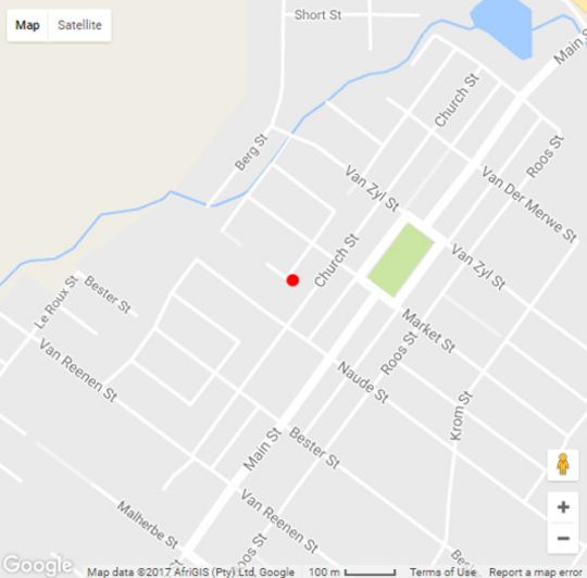
Kaartaanwysings
From Gauteng: * N3 from Johannesburg to Villiers. * Take off ramp after the Engen One-Stop and cross highway en route to Frankfort. * Pass Frankfort and, immediately after crossing the bridge over the Wilge River, take left turn to Tweeling and Reitz. * Continue past Reitz to Bethlehem. * Travel straight through town (no turnoffs) and continue for about 5km on N5. * Upon reaching the Saulspoort dam, turn right to Clarens on the R711 - R712. From Bloemfontein: * N1 to Winburg. * Take off ramp at Winburg onto the N5 to Bethlehem. * Continue on N5 through Bethlehem to top end of town (East) and turn right at Metropolitan Shopping centre. * Still on the N5, continue for about 5km until Saulspoort dam. * Turn right on R711-R712 to Clarens. * Approx distances (km), Bloemfontein to Winburg 115 Winburg to Behlehem 130 Bethlehem to Clarens 40. From Durban: * N3 to Harrismith. * Stay left at Harrismith and avoid the ringroad. * Follow N5 Bethlehem signs and take the N5 to Bethlehem. * About 5klm before Bethlehem (at the Saulspoort dam) turn left onto R711-R712 to Clarens. * Approx distances (km), Durban to Harrismith 300 Harrismith to Bethlehem 80 Bethlehem to Clarens 35.